All ten provinces now mapped with precision LiDAR data, serving automotive and infrastructure industries
Dynamic Map Platform (DMP) announces the completion of its coast-to-coast high-definition map in Canada. The addition of Newfoundland & Labrador and Prince Edward Island brings DMP's total Canadian coverage to 120,636 miles across all ten provinces including the top four road classes. The Northeast Canadian mileage expands DMP's existing North American coverage to more than 970,000 miles.
This press release features multimedia. View the full release here: https://www.businesswire.com/news/home/20260216328809/en/
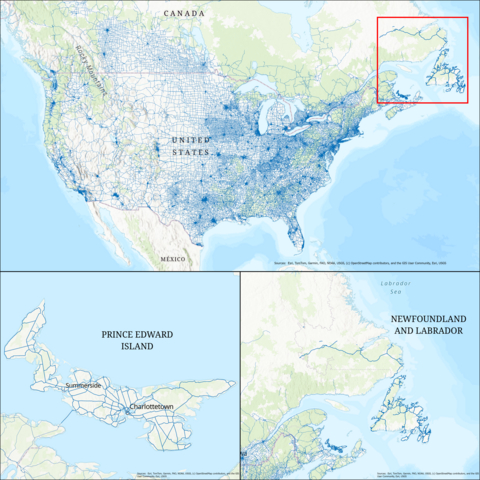
DMP adds HD Map coverage of Prince Edward Island and Newfoundland and Labrador
Automotive OEMs rely on HD maps for safe deployment of ADAS/AV functions and DMP is a coverage and accuracy leader in this domain. This expansion positions DMP to provide infrastructure data to multiple industries and road authorities. Precise geospatial data is critical to an expanding range of applications including infrastructure planning, traffic simulation, logistics automation and robotics.
Ground-Truth Data is Mission Critical
DMP's LiDAR-based maps include hundreds of roadway features with 15-cm accuracy. Ground-truth data delivers the Certainty that businesses need:
- Automotive: Advanced driver assistance systems, automated driving, vehicle simulation, and testing platforms
- Government Agencies: Asset management, AV certification, and transportation policy development
- Transportation Planning: Traffic flow modeling, intersection analysis, and roadway capacity studies
- Logistics Automation: Geo-fencing, edge case detection, extended horizon
- Architecture, Engineering & Construction (AEC): Intelligent infrastructure planning, site modeling, and future-proofing roadways for automation
DMP uses state-of-the-art LiDAR and imagery to capture observable features such as lane dividers, pedestrian crossings, and stop signs and supplements these with virtual features such as turn trajectories and light-to-lane assignments.
"Canada's coast-to-coast coverage demonstrates our commitment to building a comprehensive geospatial infrastructure that serves industries beyond automotive," said Rajeev Joshi, President of DMP North America. "Precise roadway data is a foundation for safe automation across the transportation and construction industries."
DMP continues to expand its global footprint with coverage in Japan, Korea, Middle East, and Western European countries, positioning the company as the leading provider of automotive-grade HD maps and multi-industry geospatial solutions worldwide.
For more information about Dynamic Map Platform, please visit dmp-maps.com
About Dynamic Map Platform
Dynamic Map Platform is the leading geospatial measurement and mapping company supplying HD maps and software for today’s advanced driver assistance systems and tomorrow’s autonomous vehicles. DMP’s purpose is to build a high-precision location-based infrastructure globally as a foundation for a digital society and opening up a new future for autonomous driving and other industries.
View source version on businesswire.com: https://www.businesswire.com/news/home/20260216328809/en/
Contacts
Trip Bonds, pr@dmp-maps.com